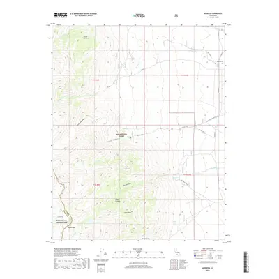
2018 Map of Aberdeen
USGS Topo · Published 2018About this map
Aberdeen sits at the eastern edge of this landscape, where the valley floor meets the dramatic rise of the Sierra Nevada. The terrain transitions from the relatively flat lands traversed by Old Hwy 395 and Tinemaha Rd into the high-altitude wilderness of the Inyo National Forest and Kings Canyon National Park. The map documents a complex system of drainage and water sources essential to this arid region, including Taboose Creek, Goodale Creek, and Division Creek. In the higher elevations, the geography is defined by prominent landmarks like Colosseum Mtn and the steep passage at Sawmill Pass. Significant historical and natural features such as Sawmill Meadows, Shingle Mill Bench, and several named water sources like Harry Birch Springs indicate the intersection of early industry and natural geography in Inyo County.
Find a feature on this map
33 named features on this map. Tap any name to fly to it.
Don’t see what you’re looking for? This feature index may not catch every label — zoom into the map to look around manually.
Map Details
Editions of this 2018 Aberdeen Map
This is the sole edition of this map. No revisions or reprints were ever made.
Other maps of this area

1907 · Mt. Whitney
USGS Topo · 1:125,000

1913 · Bishop
USGS Topo · 1:125,000

1919 · Mt. Whitney
USGS Topo · 1:125,000

1937 · Mt. Whitney
USGS Topo · 1:125,000

1947 · Mariposa
USGS Topo · 1:250,000

1948 · Fresno
USGS Topo · 1:250,000

1948 · Mariposa
USGS Topo · 1:250,000

1950 · Big Pine
USGS Topo · 1:62,500

1951 · Waucoba Mtn.
USGS Topo · 1:62,500

1951 · Independence
USGS Topo · 1:62,500