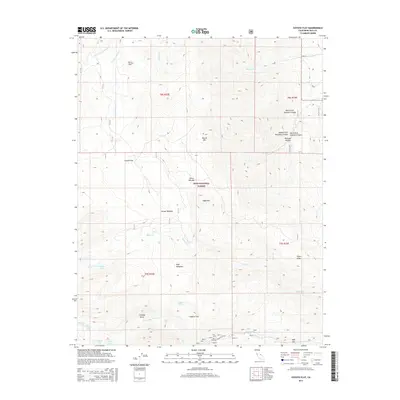
2015 Map of Coyote Flat
USGS Topo · Published 2015About this map
Inyo National Forest encompasses this high-altitude landscape where the Sierra Nevada peaks meet the Owens Valley watershed. The high plateau of Coyote Flat dominates the central terrain, bordered by steep-walled drainages including Shannon Canyon and the headwaters of Baker Creek. At the base of the mountains, Glacier Lodge Road provides access toward the southern glacial lakes. The map documents an intricate network of alpine water sources such as Summit Lake, Black Lake, and Hidden Lake, alongside distinctive clearings like Sanger Meadow and Cienega Mirth. These features illustrate the seasonal grazing and recreational history of the Eastern Sierra. Notable landmarks like Round Mtn and Sugarloaf rise above the flats, while the transition from High Meadows to Logging Flat reflects historical land use patterns before these areas were primarily managed for conservation and backcountry recreation.
Find a feature on this map
37 named features on this map. Tap any name to fly to it.
Don’t see what you’re looking for? This feature index may not catch every label — zoom into the map to look around manually.
Map Details
Editions of this 2015 Coyote Flat Map
This is the sole edition of this map. No revisions or reprints were ever made.
Other maps of this area

1912 · Mt. Goddard
USGS Topo · 1:125,000

1913 · Bishop
USGS Topo · 1:125,000

1947 · Mariposa
USGS Topo · 1:250,000

1948 · Mariposa
USGS Topo · 1:250,000

1948 · Mt. Goddard
USGS Topo · 1:62,500

1949 · Mt. Tom
USGS Topo · 1:62,500

1949 · Bishop
USGS Topo · 1:62,500

1950 · Big Pine
USGS Topo · 1:62,500

1951 · Mt. Tom
USGS Topo · 1:62,500

1951 · Mt. Goddard
USGS Topo · 1:62,500