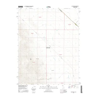
2015 Map of Sand Spring
USGS Topo · Published 2015About this map
Death Valley National Park encompasses the majority of this landscape, where the high elevations of the Last Chance Range descend into the northern reaches of the Mojave Desert. This arid environment is defined by its seasonal drainage network, including the prominent Death Valley Wash and Oriental Wash, which channel runoff from the surrounding peaks toward the floor of Death Valley. The presence of reliable water sources like Sand Spring and Little Sand Spring marks critical points in a region otherwise characterized by extreme dryness. Human infrastructure is limited to the historic corridor of Big Pine Rd, which serves as the primary route through this remote portion of Inyo County, cutting across a terrain of alluvial fans and desert washes near the California-Nevada border.
Find a feature on this map
17 named features on this map. Tap any name to fly to it.
Don’t see what you’re looking for? This feature index may not catch every label — zoom into the map to look around manually.
Map Details
Editions of this 2015 Sand Spring Map
This is the sole edition of this map. No revisions or reprints were ever made.
Other maps of this area

1908 · Lida
USGS Topo · 1:250,000

1913 · Lida
USGS Topo · 1:250,000

1954 · Goldfield
USGS Topo · 1:250,000

1955 · Goldfield
USGS Topo · 1:250,000

1957 · Magruder Mtn
USGS Topo · 1:62,500

1957 · Ubehebe Crater
USGS Topo · 1:62,500

1958 · Goldfield
USGS Topo · 1:250,000

1958 · Last Chance Range
USGS Topo · 1:62,500

1962 · Goldfield
USGS Topo · 1:250,000
1968 · Gold Point SW
USGS Topo · 1:24,000