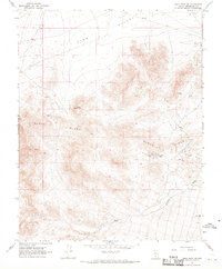
1968 Map of Gold Point SW
USGS Topo · Published 1970About this map
Slate Ridge dominates the center of this high-desert landscape in Esmeralda County, reflecting a period of active mining and exploratory transit in the late 1960s. The topography is defined by the steep rises of Black Mountain and the broad expanse of the Lida Valley to the north. Evidence of mineral exploration is scattered throughout the terrain, from the Enterprise Mine and its associated Gravel Pit to various unnamed Mines tucked into the ridgelines.
Find a feature on this map
12 named features on this map. Tap any name to fly to it.
Don’t see what you’re looking for? This feature index may not catch every label — zoom into the map to look around manually.
Map Details
Editions of this 1968 Gold Point SW Map
3 editions found
Other maps of this area

1908 · Lida
USGS Topo · 1:250,000

1913 · Lida
USGS Topo · 1:250,000

1954 · Goldfield
USGS Topo · 1:250,000

1955 · Goldfield
USGS Topo · 1:250,000

1957 · Magruder Mtn
USGS Topo · 1:62,500

1957 · Ubehebe Crater
USGS Topo · 1:62,500

1958 · Goldfield
USGS Topo · 1:250,000

1958 · Last Chance Range
USGS Topo · 1:62,500

1962 · Goldfield
USGS Topo · 1:250,000

1968 · Lida
USGS Topo · 1:24,000