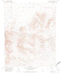
1968 Map of Gold Point SW
USGS Topo · Published 1982About this map
Slate Ridge dominates this high-desert landscape in Esmeralda County, where extraction and livestock once drove the local economy. The terrain transitions from the broad Lida Valley in the north to the elevations of Black Mountain, intersected by a network of unimproved roads and a Jeep Trail. Evidence of the region's mining heritage is scattered across the slopes, most notably at the Enterprise Mine and several other unnamed Mines.
Find a feature on this map
11 named features on this map. Tap any name to fly to it.
Don’t see what you’re looking for? This feature index may not catch every label — zoom into the map to look around manually.
Map Details
Editions of this 1968 Gold Point SW Map
3 editions found
Other maps of this area

1908 · Lida
USGS Topo · 1:250,000

1913 · Lida
USGS Topo · 1:250,000

1954 · Goldfield
USGS Topo · 1:250,000

1955 · Goldfield
USGS Topo · 1:250,000

1957 · Magruder Mtn
USGS Topo · 1:62,500

1957 · Ubehebe Crater
USGS Topo · 1:62,500

1958 · Goldfield
USGS Topo · 1:250,000

1958 · Last Chance Range
USGS Topo · 1:62,500

1962 · Goldfield
USGS Topo · 1:250,000

1968 · Lida
USGS Topo · 1:24,000