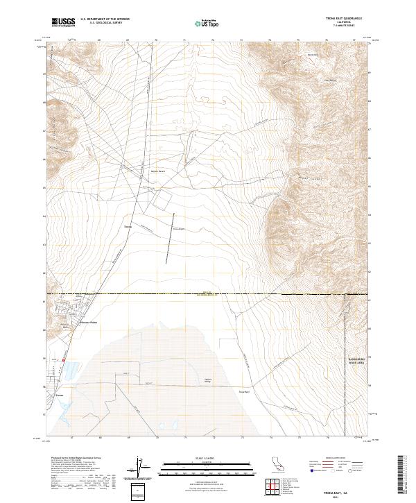
2021 Map of Trona East
USGS Topo · Published 2021About this map
Trona and the adjacent settlement of Pioneer Point sit at the western edge of this desert landscape, where industrial activity and residential life meet the arid expanse of Searles Valley. The map reveals a community defined by its proximity to the mineral wealth of the region, with infrastructure like Trona Airport and numerous haul roads such as Stockwell Mine Rd and Standard Mine Rd leading into the surrounding heights. To the east, the Slate Range rises sharply, cut by dramatic features like Goff Canyon and Bundy Canyon, while Manly Pass offers a transit point through the high terrain.
Find a feature on this map
47 named features on this map. Tap any name to fly to it.
Don’t see what you’re looking for? This feature index may not catch every label — zoom into the map to look around manually.
Map Details
Editions of this 2021 Trona East Map
This is the sole edition of this map. No revisions or reprints were ever made.
Other maps of this area

1915 · Searles Lake
USGS Topo · 1:250,000

1947 · Trona
USGS Topo · 1:250,000

1948 · Trona
USGS Topo · 1:250,000

1949 · Trona
USGS Topo · 1:62,500

1949 · Searles Lake
USGS Topo · 1:62,500

1950 · Searles Lake
USGS Topo · 1:62,500

1950 · Trona
USGS Topo · 1:62,500

1950 · Manly Peak
USGS Topo · 1:62,500

1950 · Wingate Pass
USGS Topo · 1:62,500

1951 · Wingate Pass
USGS Topo · 1:62,500