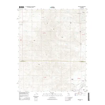
2015 Map of Trona West
USGS Topo · Published 2015About this map
Searles Valley provides the dramatic setting for this desert landscape, where the industrial settlements of Trona and Argus are situated at the edge of the dry lake bed. The terrain is dominated by the Argus Range, culminating at Argus Peak, which divides the valley from the high desert canyons to the north. This 2015 survey reveals a complex network of springs, such as Nadeau Springs, Indian Joe Spring, and Mumford Springs, which represent vital water sources in an otherwise arid environment. The map details the transition from the Mojave Desert floor into steep corridors like Burro Canyon and Wilson Canyon. Infrastructure supporting the local mineral industry is evident through specialized roads like Plant Access Rd and Trona Dump Rd, reflecting the area's long-standing economic ties to the valley's unique geology.
Find a feature on this map
45 named features on this map. Tap any name to fly to it.
Don’t see what you’re looking for? This feature index may not catch every label — zoom into the map to look around manually.
Map Details
Editions of this 2015 Trona West Map
This is the sole edition of this map. No revisions or reprints were ever made.
Other maps of this area

1915 · Searles Lake
USGS Topo · 1:250,000

1947 · Trona
USGS Topo · 1:250,000

1948 · Trona
USGS Topo · 1:250,000

1949 · Trona
USGS Topo · 1:62,500

1949 · Searles Lake
USGS Topo · 1:62,500

1950 · Searles Lake
USGS Topo · 1:62,500

1950 · Trona
USGS Topo · 1:62,500

1953 · Mountain Springs Canyon
USGS Topo · 1:62,500

1953 · Ridgecrest
USGS Topo · 1:62,500

1953 · Trona
USGS Topo · 1:250,000