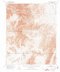
1950 Map of Wingate Wash
USGS Topo · Published 1974About this map
Indian Ranch sits at the base of the Panamint Range, marking a pocket of settlement in this arid landscape. This mid-century survey illustrates the industrial footprint within the Death Valley National Monument, particularly the mining operations at Queen of Sheba Mine and Warm Spring Mine. The geography is defined by extreme relief, descending from high peaks like Sugarloaf Pk into the Death Valley (Depression).
Find a feature on this map
27 named features on this map. Tap any name to fly to it.
Don’t see what you’re looking for? This feature index may not catch every label — zoom into the map to look around manually.
Map Details
Editions of this 1950 Wingate Wash Map
4 editions found

Other maps of this area

1908 · Furnace Creek
USGS Topo · 1:250,000

1908 · Ballarat
USGS Topo · 1:250,000

1910 · Furnace Creek
USGS Topo · 1:250,000

1913 · Ballarat
USGS Topo · 1:250,000

1915 · Searles Lake
USGS Topo · 1:250,000

1933 · Avawatz Mountains
USGS Topo · 1:250,000

1947 · Trona
USGS Topo · 1:250,000

1948 · Trona
USGS Topo · 1:250,000

1948 · Death Valley
USGS Topo · 1:250,000

1948 · Quail Mountains
USGS Topo · 1:62,500