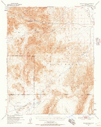
1950 Map of Wingate Wash
USGS Topo · Published 1957About this map
Indian Ranch sits at the northern edge of this high-desert landscape, where the rugged peaks of the Panamint Range meet the vast depression of Death Valley. Surveyed in 1950, this map documents a region defined by isolation and the search for precious resources. Mining activity is concentrated around Warm Spring Canyon, featuring the Queen of Sheba Mine and the Warm Spring Mine. These sites, along with various prospects, suggest a mid-century reliance on small-scale extraction in some of California's most demanding terrain.
Find a feature on this map
22 named features on this map. Tap any name to fly to it.
Don’t see what you’re looking for? This feature index may not catch every label — zoom into the map to look around manually.
Map Details
Editions of this 1950 Wingate Wash Map
4 editions found

Other maps of this area

1908 · Furnace Creek
USGS Topo · 1:250,000

1908 · Ballarat
USGS Topo · 1:250,000

1910 · Furnace Creek
USGS Topo · 1:250,000

1913 · Ballarat
USGS Topo · 1:250,000

1915 · Searles Lake
USGS Topo · 1:250,000

1933 · Avawatz Mountains
USGS Topo · 1:250,000

1947 · Trona
USGS Topo · 1:250,000

1948 · Trona
USGS Topo · 1:250,000

1948 · Death Valley
USGS Topo · 1:250,000

1948 · Quail Mountains
USGS Topo · 1:62,500