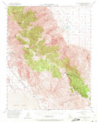
1950 Map of New York Butte
USGS Topo · Published 1972About this map
Inyo Mountains topography dominates this mid-century survey, revealing a landscape defined by high-altitude mining and the industrial infrastructure of the Owens Valley. The map documents a complex network of resource extraction, from the Bonham Talc Mines and Keynot Mine to the quarries near Dolomite. A notable logistical feat is visible in the long Tramway (Abandoned) stretching from the heights near Cerro Gordo Pk down toward the Pacific Southern rail line. Along the western edge, the shoreline of Owens Lake meets the small settlements of Swansea and Alico, while the interior remains sparsely populated, punctuated only by isolated locations like Beveridge and various springs such as Daisy Spring. The presence of the Estelle Tunnel and Bighorn Mine further underscores the era's focus on subterranean mineral wealth.
Find a feature on this map
48 named features on this map. Tap any name to fly to it.
Don’t see what you’re looking for? This feature index may not catch every label — zoom into the map to look around manually.
Map Details
Editions of this 1950 New York Butte Map
3 editions found

Other maps of this area

1905 · Olancha
USGS Topo · 1:125,000

1907 · Olancha
USGS Topo · 1:125,000

1907 · Mt. Whitney
USGS Topo · 1:125,000

1908 · Ballarat
USGS Topo · 1:250,000

1913 · Ballarat
USGS Topo · 1:250,000

1919 · Mt. Whitney
USGS Topo · 1:125,000

1937 · Mt. Whitney
USGS Topo · 1:125,000

1948 · Death Valley
USGS Topo · 1:250,000

1948 · Fresno
USGS Topo · 1:250,000

1950 · Darwin
USGS Topo · 1:62,500