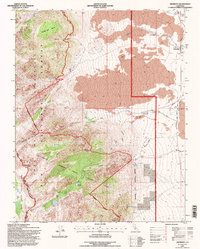
1994 Map of Aberdeen
USGS Topo · Published 1997About this map
Aberdeen sits at the edge of a dramatic vertical landscape where the high peaks of the Sierra Nevada meet the Owens Valley floor. This 1990s revision shows the complex water management infrastructure essential to the region, featuring the Aqueduct and the Division Creek Powerhouse alongside several Gaging Stations. The map details the intersection of multiple protected lands, including the John Muir Wilderness, Inyo National Forest, and the Bighorn Sheep Zoological Area, reflecting a mid-century emphasis on habitat preservation. Historical land use is evident in the scattered markings for a Shaft, Tunnel, and various Prospects in the higher elevations. From the sub-alpine environment of Sawmill Meadow and Sawmill Pass down to the alluvial fans of Taboose Creek and Goodale Creek, the map records a wilderness transition shaped by both natural watercourses and human engineering.
Find a feature on this map
33 named features on this map. Tap any name to fly to it.
Don’t see what you’re looking for? This feature index may not catch every label — zoom into the map to look around manually.
Map Details
Editions of this 1994 Aberdeen Map
2 editions found
Other maps of this area

1907 · Mt. Whitney
USGS Topo · 1:125,000

1913 · Bishop
USGS Topo · 1:125,000

1919 · Mt. Whitney
USGS Topo · 1:125,000

1937 · Mt. Whitney
USGS Topo · 1:125,000

1947 · Mariposa
USGS Topo · 1:250,000

1948 · Fresno
USGS Topo · 1:250,000

1948 · Mariposa
USGS Topo · 1:250,000

1950 · Big Pine
USGS Topo · 1:62,500

1951 · Waucoba Mtn.
USGS Topo · 1:62,500

1951 · Independence
USGS Topo · 1:62,500