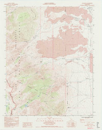
1994 Map of Aberdeen
USGS Topo · Published 1994About this map
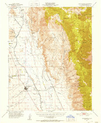
Aberdeen sits at the edge of a landscape defined by dramatic geological and hydrologic features, where water resources are carefully managed through facilities like the Division Creek Powerhouse. This 1994 update documents the intricate overlap of jurisdictional boundaries, including the John Muir Wilderness, Inyo National Forest, and Kings Canyon National Park. The survey captures a network of 4WD tracks and trails leading to high-altitude landmarks such as Colosseum Mtn and Sawmill Pass. Numerous springs, including Harry Birch Springs and Grover Anton Spring, suggest the critical importance of water in this arid environment. The map also records industrial and recreational footprints, from a Barrow Pit and various Prospects to several campgrounds along Taboose Creek and Goodale Creek. Along the slopes, the Bighorn Sheep Zoological Area highlights the region's role as a protected habitat.
Find a feature on this map
37 named features on this map. Tap any name to fly to it.
Don’t see what you’re looking for? This feature index may not catch every label — zoom into the map to look around manually.
Map Details
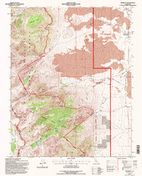
Editions of this 1994 Aberdeen Map
2 editions found
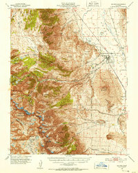
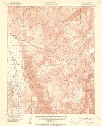
Other maps of this area

1907 · Mt. Whitney
USGS Topo · 1:125,000

1913 · Bishop
USGS Topo · 1:125,000

1919 · Mt. Whitney
USGS Topo · 1:125,000

1937 · Mt. Whitney
USGS Topo · 1:125,000

1947 · Mariposa
USGS Topo · 1:250,000

1948 · Fresno
USGS Topo · 1:250,000

1948 · Mariposa
USGS Topo · 1:250,000
1950 · Big Pine
USGS Topo · 1:62,500
1951 · Waucoba Mtn.
USGS Topo · 1:62,500
1951 · Independence
USGS Topo · 1:62,500