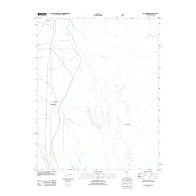
2012 Map of Blackrock
USGS Topo · Published 2012About this map
Blackrock and Taboose Ranch sit at the western edge of a landscape defined by industrial water management and the natural course of the Owens River. This 2012 survey illustrates the complex hydraulic network of the Owens Valley, where the Los Angeles Aqueduct and several man-made diversions like the Aberdeen Bypass Ditch and Division Creek Ditch crisscross the valley floor. The map highlights the local significance of the Black Rock Fish Hatchery and numerous natural water sources including Little Blackrock Spring and Hines Spring. In the east, the terrain rises toward Crystal Ridge, while the lowlands are marked by Twin Lakes and Calvert Lake. The transition from old transit routes like Old Hwy 395 to contemporary forest and local roads such as Coliseum Rd shows the evolving infrastructure of this Inyo County region.
Find a feature on this map
24 named features on this map. Tap any name to fly to it.
Don’t see what you’re looking for? This feature index may not catch every label — zoom into the map to look around manually.
Map Details
Editions of this 2012 Blackrock Map
This is the sole edition of this map. No revisions or reprints were ever made.
Other maps of this area

1907 · Mt. Whitney
USGS Topo · 1:125,000

1913 · Bishop
USGS Topo · 1:125,000

1919 · Mt. Whitney
USGS Topo · 1:125,000

1937 · Mt. Whitney
USGS Topo · 1:125,000

1947 · Mariposa
USGS Topo · 1:250,000

1948 · Fresno
USGS Topo · 1:250,000

1948 · Mariposa
USGS Topo · 1:250,000

1950 · Big Pine
USGS Topo · 1:62,500

1951 · Waucoba Mtn.
USGS Topo · 1:62,500

1951 · Independence
USGS Topo · 1:62,500