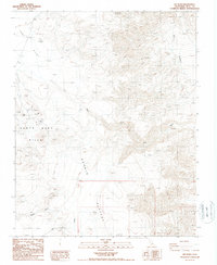
1987 Map of Lee Wash
USGS Topo · Published 1987About this map
The Lee Flat and the Santa Rosa Hills define the high desert topography of this region during the 1980s. This survey records a landscape shaped by intermittent mineral exploration and remote ranching, centered on the historic Lee Mines and the Wilson Ranch (Site). The drainage patterns of Lee Wash and Santa Rosa Wash underscore the arid character of the Darwin Plateau, where water only occasionally flows through features like the Falls or down Mill Canyon. Several Prospects and an isolated Borrow Pit indicate the persistent human effort to extract value from the dry ground, offering local historians and researchers a record of resource-based activity in this portion of Inyo County before modern changes to land access.
Find a feature on this map
12 named features on this map. Tap any name to fly to it.
Don’t see what you’re looking for? This feature index may not catch every label — zoom into the map to look around manually.
Map Details
Editions of this 1987 Lee Wash Map
This is the sole edition of this map. No revisions or reprints were ever made.
Other maps of this area

1908 · Ballarat
USGS Topo · 1:250,000

1913 · Ballarat
USGS Topo · 1:250,000

1948 · Death Valley
USGS Topo · 1:250,000

1950 · Darwin
USGS Topo · 1:62,500

1950 · Ubehebe Peak
USGS Topo · 1:62,500

1951 · Darwin
USGS Topo · 1:62,500

1951 · Ubehebe Peak
USGS Topo · 1:62,500

1951 · Panamint Butte
USGS Topo · 1:62,500

1951 · Marble Canyon
USGS Topo · 1:62,500

1954 · Death Valley
USGS Topo · 1:250,000