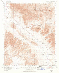
1950 Map of Confidence Hills
USGS Topo · Published 1968About this map
Ashford Mill (Ruins) stands at the base of the Black Mountains, marking a era of industrial effort in the southern reach of Death Valley. This 1950 field check reveals a landscape where the Amargosa River flows through a deep depression, surrounded by the sharp elevations of the Owlshead Mountains and the Confidence Hills. The mapping records specific mining activity at the Ashford Mine and the Desert Hound Mine, alongside smaller operations like the Confidence Mill (Site). Natural water sources were critical for these isolated ventures, evidenced by Virgin Spring, Rhodes Spring, and Bradbury Well. The terrain is punctuated by landmarks such as Shore Line Butte and Jubilee Mtn, while the Death Valley National Monument Boundary tracks across the arid wash of the Rhodes Wash.
Find a feature on this map
31 named features on this map. Tap any name to fly to it.
Don’t see what you’re looking for? This feature index may not catch every label — zoom into the map to look around manually.
Map Details
Editions of this 1950 Confidence Hills Map
3 editions found

Other maps of this area

1908 · Furnace Creek
USGS Topo · 1:250,000

1910 · Furnace Creek
USGS Topo · 1:250,000

1933 · Avawatz Mountains
USGS Topo · 1:250,000

1940 · Eagle Tank
USGS Topo · 1:62,500

1947 · Trona
USGS Topo · 1:250,000

1948 · Trona
USGS Topo · 1:250,000

1948 · Death Valley
USGS Topo · 1:250,000

1948 · Quail Mountains
USGS Topo · 1:62,500

1948 · Leach Lake
USGS Topo · 1:62,500

1948 · Avawatz Pass
USGS Topo · 1:62,500