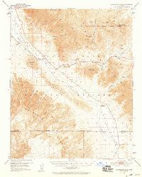
1950 Map of Confidence Hills
USGS Topo · Published 1958About this map
The Amargosa River cuts through the extreme topography of the southern Death Valley (Depression), illustrating the harsh environmental constraints of the Mojave desert during the mid-century. This survey documents the scattered remains of late-19th and early-20th-century gold and silver extraction, most notably at the Ashford Mill (Ruins) and the nearby Ashford Mine. The landscape is a network of arid washes and springs, such as Bradbury Well and Virgin Spring, which served as vital waypoints for prospectors and travelers navigating between the Black Mountains and the Owlshead Mountains. Settlement in this era was defined by industrial activity rather than permanent towns, evidenced by the Confidence Mill (Site) near the Confidence Narrows. The map provides a look at the infrastructure of the Death Valley National Monument as it existed before modern expansion, recording old mining tracks and the precarious passage through Jubilee Pass.
Find a feature on this map
34 named features on this map. Tap any name to fly to it.
Don’t see what you’re looking for? This feature index may not catch every label — zoom into the map to look around manually.
Map Details
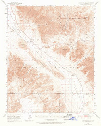
Editions of this 1950 Confidence Hills Map
3 editions found

Other maps of this area

1908 · Furnace Creek
USGS Topo · 1:250,000

1910 · Furnace Creek
USGS Topo · 1:250,000

1933 · Avawatz Mountains
USGS Topo · 1:250,000

1940 · Eagle Tank
USGS Topo · 1:62,500

1947 · Trona
USGS Topo · 1:250,000

1948 · Trona
USGS Topo · 1:250,000

1948 · Death Valley
USGS Topo · 1:250,000

1948 · Quail Mountains
USGS Topo · 1:62,500

1948 · Leach Lake
USGS Topo · 1:62,500

1948 · Avawatz Pass
USGS Topo · 1:62,500