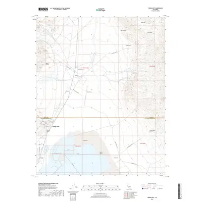
2018 Map of Trona East
USGS Topo · Published 2018About this map
Borax Flat and the expansive basin of Searles Valley dominate this landscape, sitting at the junction of the Inyo and San Bernardino county line. The settlement of Trona serves as the primary hub, surrounded by a network of industrial and access roads like Stockwell Mine Rd and Copper Queen Canyon Rd that lead into the high desert terrain. The area is hemmed in by the Argus Range to the west and the Slate Range to the east, with distinctive geological features such as Trona Reef and Point of Rocks marking the transition from the valley floor to the desert uplands.
Find a feature on this map
40 named features on this map. Tap any name to fly to it.
Don’t see what you’re looking for? This feature index may not catch every label — zoom into the map to look around manually.
Map Details
Editions of this 2018 Trona East Map
This is the sole edition of this map. No revisions or reprints were ever made.
Other maps of this area

1915 · Searles Lake
USGS Topo · 1:250,000

1947 · Trona
USGS Topo · 1:250,000

1948 · Trona
USGS Topo · 1:250,000

1949 · Trona
USGS Topo · 1:62,500

1949 · Searles Lake
USGS Topo · 1:62,500

1950 · Searles Lake
USGS Topo · 1:62,500

1950 · Trona
USGS Topo · 1:62,500

1950 · Manly Peak
USGS Topo · 1:62,500

1950 · Wingate Pass
USGS Topo · 1:62,500

1951 · Wingate Pass
USGS Topo · 1:62,500