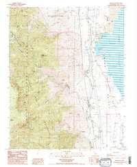
1987 Map of Bartlett
USGS Topo · Published 1991About this map
Owens Lake and its industrial shoreline dominate this late 1980s landscape, where mineral extraction and water management intersect at the edge of the Inyo National Forest. The settlement of Bartlett serves as a focal point for the regional infrastructure, situated near extensive Soda Evaporators and an Old Railroad Grade that traces the valley floor. The map documents a complex network of resource utility, from the Los Angeles Aqueduquct and Cottonwood Power Plant to the scattered Kilns and Borrow Pits that suggest a history of active local industry. High-elevation landmarks like Wonoga Peak and Muah Mountain rise sharply to the west, marking the transition into the Golden Trout Wilderness. This survey captures a moment when the Owens Valley ecosystem was defined by both its extreme topography and its intensive human modifications for water and mineral recovery.
Find a feature on this map
36 named features on this map. Tap any name to fly to it.
Don’t see what you’re looking for? This feature index may not catch every label — zoom into the map to look around manually.
Map Details
Editions of this 1987 Bartlett Map
3 editions found
Other maps of this area

1905 · Olancha
USGS Topo · 1:125,000

1907 · Olancha
USGS Topo · 1:125,000

1907 · Mt. Whitney
USGS Topo · 1:125,000

1908 · Ballarat
USGS Topo · 1:250,000

1913 · Ballarat
USGS Topo · 1:250,000

1919 · Mt. Whitney
USGS Topo · 1:125,000

1937 · Mt. Whitney
USGS Topo · 1:125,000

1948 · Death Valley
USGS Topo · 1:250,000

1948 · Fresno
USGS Topo · 1:250,000

1950 · New York Butte
USGS Topo · 1:62,500