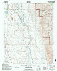
1994 Map of Poleta Canyon
USGS Topo · Published 1997About this map
Owens Valley irrigation and aviation infrastructure define this mid-1990s landscape at the foot of the White Mountains. The Owens River meanders south through the center of the sheet, flanked by the Bishop Creek Canal and Big Pine Canal, illustrating the sophisticated water management systems required for the region. To the northwest, the Bishop Airport and adjacent Bishop Airport Cem sit near a concentrated area of local utility features like Sewage Disposal Ponds and a Trailer Park.
Find a feature on this map
36 named features on this map. Tap any name to fly to it.
Don’t see what you’re looking for? This feature index may not catch every label — zoom into the map to look around manually.
Map Details
Editions of this 1994 Poleta Canyon Map
2 editions found
Other maps of this area

1913 · Bishop
USGS Topo · 1:125,000

1947 · Mariposa
USGS Topo · 1:250,000

1948 · Mariposa
USGS Topo · 1:250,000

1949 · Bishop
USGS Topo · 1:62,500

1950 · Big Pine
USGS Topo · 1:62,500

1951 · Bishop
USGS Topo · 1:62,500

1951 · Blanco Mountain
USGS Topo · 1:62,500

1951 · Waucoba Mtn.
USGS Topo · 1:62,500

1957 · Mariposa
USGS Topo · 1:250,000
1958 · Waucoba Mtn
USGS Topo · 1:62,500