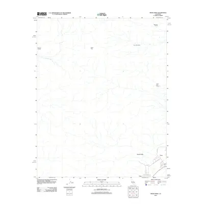
2012 Map of Trona West
USGS Topo · Published 2012About this map
Searles Valley dominates this landscape, where the settlements of Trona and Argus are situated in the southeastern corner. This area is defined by the proximity of high desert peaks and canyons to the industrial and residential grid. Argus Peak rises as a primary landmark near the center of the sheet, while drainage patterns like Sweetwater Wash and Moscow Canyon carve through the western terrain. The street layouts of the two towns are clearly delineated, including Plant Access Rd and Argus Ave, reflecting the specialized infrastructure of this desert mining region. To the north, the geography becomes more varied with features such as Great Falls Basin and Mumford Canyon, showing the complex hydrologic and topographic relief characteristic of this part of San Bernardino County.
Find a feature on this map
16 named features on this map. Tap any name to fly to it.
Don’t see what you’re looking for? This feature index may not catch every label — zoom into the map to look around manually.
Map Details
Editions of this 2012 Trona West Map
This is the sole edition of this map. No revisions or reprints were ever made.
Other maps of this area

1915 · Searles Lake
USGS Topo · 1:250,000

1947 · Trona
USGS Topo · 1:250,000

1948 · Trona
USGS Topo · 1:250,000

1949 · Trona
USGS Topo · 1:62,500

1949 · Searles Lake
USGS Topo · 1:62,500

1950 · Searles Lake
USGS Topo · 1:62,500

1950 · Trona
USGS Topo · 1:62,500

1953 · Mountain Springs Canyon
USGS Topo · 1:62,500

1953 · Ridgecrest
USGS Topo · 1:62,500

1953 · Trona
USGS Topo · 1:250,000