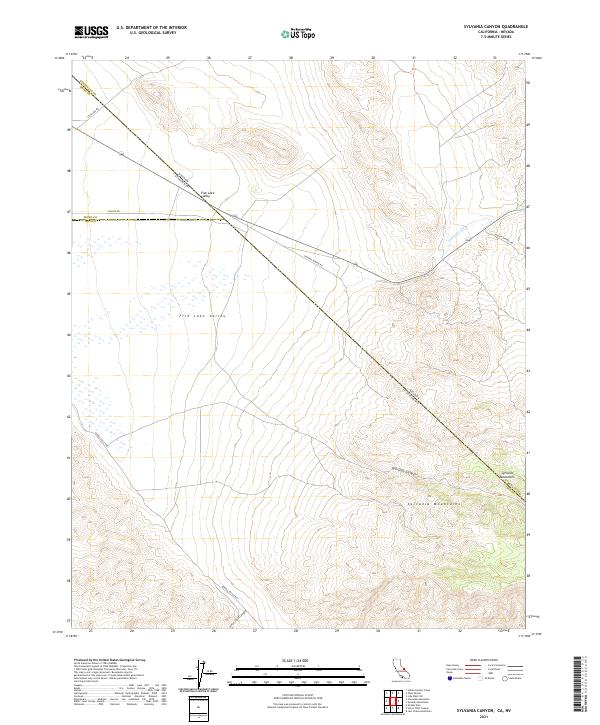
2021 Map of Sylvania Canyon
USGS Topo · Published 2021About this map
Sylvania Mountains dominate the southeastern landscape of this borderland survey, where the high desert terrain of California meets Nevada. The map documents a sparsely populated but historically active mining and ranching region, anchored by the wide expanse of Fish Lake Valley to the west. This area is defined by its drainage patterns and seasonal watercourses, notably Palmetto Wash and the winding Sylvania Canyon. The presence of Savinion Mining Rd and Pigeon Springs Rd suggests the enduring footprint of industrial extraction and early transit routes that linked these remote basins. Following the diagonal of the state boundary, State Line Rd cuts through the valley floor, illustrating the geometric precision of 21st-century border management against the natural contours of Horse Thief Canyon.
Find a feature on this map
20 named features on this map. Tap any name to fly to it.
Don’t see what you’re looking for? This feature index may not catch every label — zoom into the map to look around manually.
Map Details
Editions of this 2021 Sylvania Canyon Map
This is the sole edition of this map. No revisions or reprints were ever made.
Other maps of this area

1898 · Silver Peak
USGS Topo · 1:125,000

1900 · Silver Peak
USGS Topo · 1:125,000

1908 · Lida
USGS Topo · 1:250,000

1913 · Lida
USGS Topo · 1:250,000

1954 · Goldfield
USGS Topo · 1:250,000

1955 · Goldfield
USGS Topo · 1:250,000

1957 · Magruder Mtn
USGS Topo · 1:62,500

1958 · Goldfield
USGS Topo · 1:250,000

1958 · Soldier Pass
USGS Topo · 1:62,500

1962 · Goldfield
USGS Topo · 1:250,000