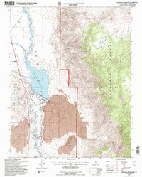
1994 Map of Tinemaha Reservoir
USGS Topo · Published 1997About this map
Tinemaha Reservoir dominates this high-desert landscape in the mid-1990s, serving as a critical infrastructure point for the Owens River. The map highlights the complex water management of the valley, featuring a massive Lava field to the south and the protective embankments of the reservoir itself, including the Outlet Tower and spillway. This area within the Inyo National Forest reveals a layered history of transportation and resource extraction.
Find a feature on this map
20 named features on this map. Tap any name to fly to it.
Don’t see what you’re looking for? This feature index may not catch every label — zoom into the map to look around manually.
Map Details
Editions of this 1994 Tinemaha Reservoir Map
2 editions found
Other maps of this area

1907 · Mt. Whitney
USGS Topo · 1:125,000

1913 · Bishop
USGS Topo · 1:125,000

1919 · Mt. Whitney
USGS Topo · 1:125,000

1937 · Mt. Whitney
USGS Topo · 1:125,000

1947 · Mariposa
USGS Topo · 1:250,000

1948 · Fresno
USGS Topo · 1:250,000

1948 · Mariposa
USGS Topo · 1:250,000

1950 · Big Pine
USGS Topo · 1:62,500

1951 · Waucoba Mtn.
USGS Topo · 1:62,500

1951 · Independence
USGS Topo · 1:62,500