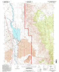
1994 Map of Tinemaha Reservoir
USGS Topo · Published 1997About this map
Tinemaha Reservoir and the winding Owens River dominate this Owens Valley landscape, showing the complex water management infrastructure maintained by the City of Los Angeles in the mid-1990s. The map illustrates a rugged geography defined by expansive Lava flows and the Poverty Hills, where numerous extractive sites like the New Era Mine and Rock Quarry point to a history of local industry.
Find a feature on this map
26 named features on this map. Tap any name to fly to it.
Don’t see what you’re looking for? This feature index may not catch every label — zoom into the map to look around manually.
Map Details
Editions of this 1994 Tinemaha Reservoir Map
2 editions found
Other maps of this area

1907 · Mt. Whitney
USGS Topo · 1:125,000

1913 · Bishop
USGS Topo · 1:125,000

1919 · Mt. Whitney
USGS Topo · 1:125,000

1937 · Mt. Whitney
USGS Topo · 1:125,000

1947 · Mariposa
USGS Topo · 1:250,000

1948 · Fresno
USGS Topo · 1:250,000

1948 · Mariposa
USGS Topo · 1:250,000

1950 · Big Pine
USGS Topo · 1:62,500

1951 · Waucoba Mtn.
USGS Topo · 1:62,500

1951 · Independence
USGS Topo · 1:62,500