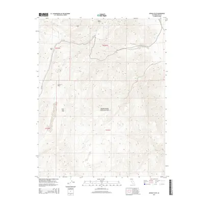
2015 Map of Joshua Flats
USGS Topo · Published 2015About this map
Death Valley National Park extends across the southern portion of this high-elevation survey, illustrating the protected wilderness where the Mojave and Great Basin deserts meet. The terrain is defined by the sharp elevations of the White-Inyo Range, which drops into the expansive Cowhorn Valley and Joshua Flats. This landscape highlights a transition from rugged peaks to alluvial basins, showing the complex geological character of Inyo County. To the north, Lime Hill overlooks the approach to the Owens Valley, while the solitary path of Big Pine Rd provides the primary corridor through this sparsely populated environment. The map details the intricate contour lines and township-range boundaries, such as t8s r36e and t9s r37e, which delineate the public land grid across this arid terrain.
Find a feature on this map
11 named features on this map. Tap any name to fly to it.
Don’t see what you’re looking for? This feature index may not catch every label — zoom into the map to look around manually.
Map Details
Editions of this 2015 Joshua Flats Map
This is the sole edition of this map. No revisions or reprints were ever made.
Other maps of this area

1908 · Lida
USGS Topo · 1:250,000

1913 · Bishop
USGS Topo · 1:125,000

1913 · Lida
USGS Topo · 1:250,000

1947 · Mariposa
USGS Topo · 1:250,000

1948 · Mariposa
USGS Topo · 1:250,000

1951 · Blanco Mountain
USGS Topo · 1:62,500

1951 · Waucoba Mtn.
USGS Topo · 1:62,500

1954 · Goldfield
USGS Topo · 1:250,000

1955 · Goldfield
USGS Topo · 1:250,000

1957 · Mariposa
USGS Topo · 1:250,000