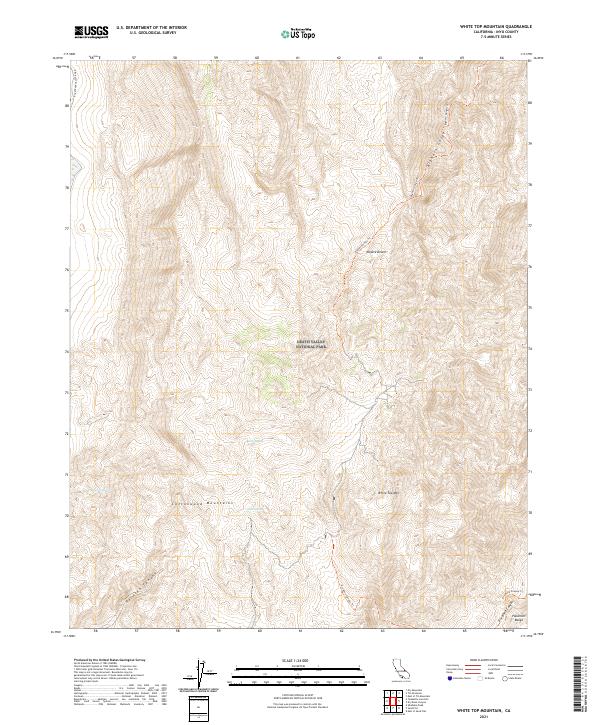
2021 Map of White Top Mountain
USGS Topo · Published 2021About this map
Death Valley National Park encompasses the high-elevation desert terrain shown here, where the Cottonwood Mountains meet the northern reaches of the Panamint Range. This arid landscape is punctuated by vital water sources like Burro Spring, Quartz Spring, and Rest Spring, which have long served as critical waypoints in a region defined by extreme elevation changes. Foot travel and historical access are traced through the Bighorn Gorge Trl and Dry Bone Canyon Trl, while Racetrack Valley Road provides the primary vehicular corridor to the west. The map captures a complex system of drainage and erosion, visible in the steep descents of Perdido Canyon and Dry Bone Canyon, which fall away from the central heights of White Top Mtn.
Find a feature on this map
20 named features on this map. Tap any name to fly to it.
Don’t see what you’re looking for? This feature index may not catch every label — zoom into the map to look around manually.
Map Details
Editions of this 2021 White Top Mountain Map
This is the sole edition of this map. No revisions or reprints were ever made.
Other maps of this area

1908 · Ballarat
USGS Topo · 1:250,000

1913 · Ballarat
USGS Topo · 1:250,000

1948 · Death Valley
USGS Topo · 1:250,000

1950 · Ubehebe Peak
USGS Topo · 1:62,500

1951 · Ubehebe Peak
USGS Topo · 1:62,500

1951 · Marble Canyon
USGS Topo · 1:62,500

1954 · Death Valley
USGS Topo · 1:250,000

1956 · Death Valley
USGS Topo · 1:250,000

1957 · Death Valley
USGS Topo · 1:250,000

1957 · Tin Mountain
USGS Topo · 1:62,500