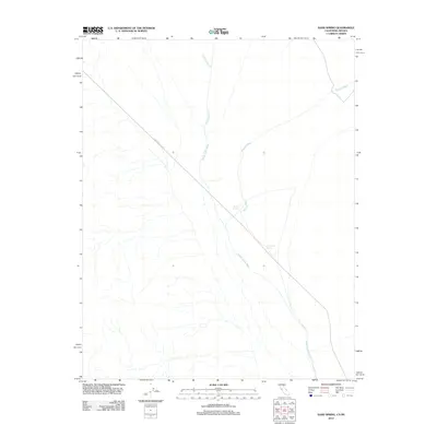
2012 Map of Sand Spring
USGS Topo · Published 2012About this map
Sand Spring and Little Sand Spring mark essential water sources in this arid stretch of Inyo County along the California-Nevada border. This landscape is defined by its drainage systems, where Cottonwood Cr and Oriental Wash converge toward the primary basin of Death Valley Wash. These intermittent waterways trace the subtle topography of the high desert, illustrating how water movement dictates the geography of the region. The map shows the solitary path of Death Valley Rd cutting diagonally through the terrain, serving as the primary corridor for travelers crossing this remote area. The convergence of these washes at the southern end of the sheet provides a detailed look at the alluvial patterns common to this part of the Mojave desert, where seasonal runoff from distant mountains shapes the dry desert floor.
Find a feature on this map
6 named features on this map. Tap any name to fly to it.
Don’t see what you’re looking for? This feature index may not catch every label — zoom into the map to look around manually.
Map Details
Editions of this 2012 Sand Spring Map
This is the sole edition of this map. No revisions or reprints were ever made.
Other maps of this area

1908 · Lida
USGS Topo · 1:250,000

1913 · Lida
USGS Topo · 1:250,000

1954 · Goldfield
USGS Topo · 1:250,000

1955 · Goldfield
USGS Topo · 1:250,000

1957 · Magruder Mtn
USGS Topo · 1:62,500

1957 · Ubehebe Crater
USGS Topo · 1:62,500

1958 · Goldfield
USGS Topo · 1:250,000

1958 · Last Chance Range
USGS Topo · 1:62,500

1962 · Goldfield
USGS Topo · 1:250,000
1968 · Gold Point SW
USGS Topo · 1:24,000