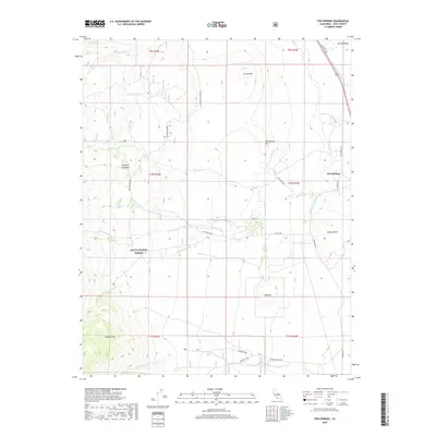
2018 Map of Fish Springs
USGS Topo · Published 2018About this map
Fish Springs sits at the eastern edge of a dramatic vertical landscape within the Inyo National Forest, where the high meadows of the Sierra Nevada transition toward the Owens Valley. The settlement pattern follows the drainage of the mountains, with McMurry Meadows Rd and Birch Creek Rd providing access into the western high country. Water management is a central theme of this 2018 survey, evidenced by the presence of the Big Pine Canal and various creeks like Fuller Cr and Tinemaha Cr. The geological character of the region is prominent, featuring distinct volcanic landmarks such as Crater Mtn and the Poverty Hills. These formations, along with Red Mtn to the south, overlook the alluvial flats of Stecker Flat and the broader valley floor, illustrating the complex hydrology and topography of Inyo County.
Find a feature on this map
37 named features on this map. Tap any name to fly to it.
Don’t see what you’re looking for? This feature index may not catch every label — zoom into the map to look around manually.
Map Details
Editions of this 2018 Fish Springs Map
This is the sole edition of this map. No revisions or reprints were ever made.
Other maps of this area

1907 · Mt. Whitney
USGS Topo · 1:125,000

1913 · Bishop
USGS Topo · 1:125,000

1919 · Mt. Whitney
USGS Topo · 1:125,000

1937 · Mt. Whitney
USGS Topo · 1:125,000

1947 · Mariposa
USGS Topo · 1:250,000

1948 · Fresno
USGS Topo · 1:250,000

1948 · Mariposa
USGS Topo · 1:250,000

1950 · Big Pine
USGS Topo · 1:62,500

1951 · Waucoba Mtn.
USGS Topo · 1:62,500

1951 · Independence
USGS Topo · 1:62,500