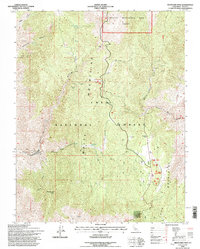
1994 Map of Westgard Pass
USGS Topo · Published 1997About this map
High-altitude mining claims and ecological preserves define this 1994 revision of the White and Inyo Mountains. The northern reach of the sheet is dominated by the Ancient Bristlecone Pine Forest, indicating the unique botanical value of this high-desert environment. Below these ridges, the landscape is scarred by extractive history, with numerous mining sites such as the Grandview Mine and the Gray Eagle Mine suggesting a period of intense mineral exploration.
Find a feature on this map
41 named features on this map. Tap any name to fly to it.
Don’t see what you’re looking for? This feature index may not catch every label — zoom into the map to look around manually.
Map Details
Editions of this 1994 Westgard Pass Map
This is the sole edition of this map. No revisions or reprints were ever made.
Other maps of this area

1913 · Bishop
USGS Topo · 1:125,000

1947 · Mariposa
USGS Topo · 1:250,000

1948 · Mariposa
USGS Topo · 1:250,000

1949 · Bishop
USGS Topo · 1:62,500

1950 · Big Pine
USGS Topo · 1:62,500

1951 · Bishop
USGS Topo · 1:62,500

1951 · Blanco Mountain
USGS Topo · 1:62,500

1951 · Waucoba Mtn.
USGS Topo · 1:62,500

1957 · Mariposa
USGS Topo · 1:250,000
1958 · Waucoba Mtn
USGS Topo · 1:62,500