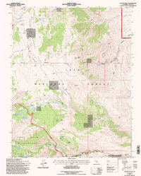
1994 Map of Coyote Flat
USGS Topo · Published 1997About this map
Coyote Flat dominates this high-altitude landscape in Inyo County, where specialized access like 4wd tracks and a remote Landing Strip reveal the area's utility for backcountry exploration and resource management. The 1990s terrain is characterized by a high basin system between the Inyo National Forest and the John Muir Wilderness, punctuated by glacial features such as Big Pine Lakes, Baker Lake, and Hidden Lake. Evidence of earlier mineral interest appears on the eastern slopes toward Shannon Canyon, where a Mine Shaft and several prospects remain. The map captures a high-country ecology of meadows and flats, including Sanger Meadow, High Meadows, and Logging Flat, which contrast with the sharp verticality of Piper Peak and Sugarloaf. This survey preserves the transition from motorized forest access to the restricted walk-in paths of the wilderness boundary.
Find a feature on this map
62 named features on this map. Tap any name to fly to it.
Don’t see what you’re looking for? This feature index may not catch every label — zoom into the map to look around manually.
Map Details
Editions of this 1994 Coyote Flat Map
This is the sole edition of this map. No revisions or reprints were ever made.
Other maps of this area

1912 · Mt. Goddard
USGS Topo · 1:125,000

1913 · Bishop
USGS Topo · 1:125,000

1947 · Mariposa
USGS Topo · 1:250,000

1948 · Mariposa
USGS Topo · 1:250,000

1948 · Mt. Goddard
USGS Topo · 1:62,500

1949 · Mt. Tom
USGS Topo · 1:62,500

1949 · Bishop
USGS Topo · 1:62,500

1950 · Big Pine
USGS Topo · 1:62,500

1951 · Mt. Tom
USGS Topo · 1:62,500

1951 · Mt. Goddard
USGS Topo · 1:62,500