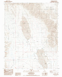
1986 Map of The Dunes
USGS Topo · Published 1986About this map
Panamint Valley serves as the central focal point of this arid landscape, where the shifting topography of The Dunes is documented alongside the sparse industrial remnants of the region. The high desert environment is characterized by dramatic elevation changes, notably where Mill Canyon and Rainbow Canyon descend toward the valley floor. Toward the northern edge of the sheet, the Monument Boundary of Death Valley National Monument marks a transition into protected federal lands. Local mining history is represented by the Big Four Mine, situated near the rugged slopes of the eastern mountains. In the southeastern portion of the quadrangle, Black Lake and the adjacent Black Lake Hill provide specific landmarks for researchers interested in the hydrologic and geologic history of this portion of Inyo County.
Find a feature on this map
10 named features on this map. Tap any name to fly to it.
Don’t see what you’re looking for? This feature index may not catch every label — zoom into the map to look around manually.
Map Details
Editions of this 1986 The Dunes Map
This is the sole edition of this map. No revisions or reprints were ever made.
Other maps of this area

1908 · Ballarat
USGS Topo · 1:250,000

1913 · Ballarat
USGS Topo · 1:250,000

1948 · Death Valley
USGS Topo · 1:250,000

1950 · Darwin
USGS Topo · 1:62,500

1950 · Ubehebe Peak
USGS Topo · 1:62,500

1951 · Darwin
USGS Topo · 1:62,500

1951 · Ubehebe Peak
USGS Topo · 1:62,500

1951 · Panamint Butte
USGS Topo · 1:62,500

1951 · Marble Canyon
USGS Topo · 1:62,500

1954 · Death Valley
USGS Topo · 1:250,000