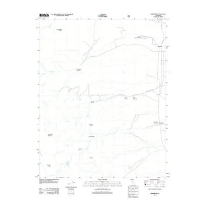
2012 Map of Aberdeen
USGS Topo · Published 2012About this map
Colosseum Mountain and The Hogsback dominate the western portion of this Inyo County landscape, where the Sierra Nevada’s steep canyons descend into the Owens Valley. The tiny settlement of Aberdeen sits at the junction of Tinemaha Rd and Old Hwy 395, serving as a gateway to high-altitude landmarks like Sawmill Pass. The map reveals an essential water-and-power infrastructure, evidenced by the Division Creek Powerhouse and numerous water sources including Harry Birch Springs and Grover Anton Spring. Recreational access is a defining characteristic of the era, with the Sawmill Pass Trailhead and multiple campsites such as Goodale Creek Campground and Taboose Creek Campground positioned where the creek drainage opens onto the valley floor. To the south, Eightmile Ranch suggests the area's ongoing agricultural or pastoral utility alongside its role as a recreation hub.
Find a feature on this map
30 named features on this map. Tap any name to fly to it.
Don’t see what you’re looking for? This feature index may not catch every label — zoom into the map to look around manually.
Map Details
Editions of this 2012 Aberdeen Map
This is the sole edition of this map. No revisions or reprints were ever made.
Other maps of this area

1907 · Mt. Whitney
USGS Topo · 1:125,000

1913 · Bishop
USGS Topo · 1:125,000

1919 · Mt. Whitney
USGS Topo · 1:125,000

1937 · Mt. Whitney
USGS Topo · 1:125,000

1947 · Mariposa
USGS Topo · 1:250,000

1948 · Fresno
USGS Topo · 1:250,000

1948 · Mariposa
USGS Topo · 1:250,000

1950 · Big Pine
USGS Topo · 1:62,500

1951 · Waucoba Mtn.
USGS Topo · 1:62,500

1951 · Independence
USGS Topo · 1:62,500