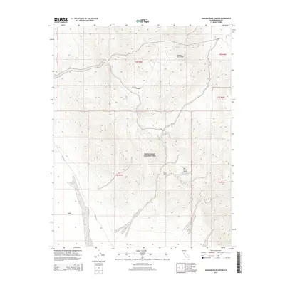
2015 Map of Hanging Rock Canyon
USGS Topo · Published 2015About this map
Death Valley National Park encompasses much of this arid landscape, characterized by the dramatic elevation changes between the Eureka Valley and the peaks of the Last Chance Range. This area of the Mojave Desert is dominated by the geological presence of the Crater, which sits at a high point overlooking the deep incision of Hanging Rock Canyon. This terrain serves as a clear example of the basin-and-range topography typical of Inyo County, where isolated roads like S Eureka Rd and Sulfur Rd navigate the steep contours and desert washes. The map provides a precise look at the township and range boundaries that grid this portion of the park, including t8s r39e and t8s r40e, offering researchers a detailed study of the land survey system in one of the most remote parts of the American West.
Find a feature on this map
12 named features on this map. Tap any name to fly to it.
Don’t see what you’re looking for? This feature index may not catch every label — zoom into the map to look around manually.
Map Details
Editions of this 2015 Hanging Rock Canyon Map
This is the sole edition of this map. No revisions or reprints were ever made.
Other maps of this area

1908 · Lida
USGS Topo · 1:250,000

1913 · Lida
USGS Topo · 1:250,000

1954 · Goldfield
USGS Topo · 1:250,000

1955 · Goldfield
USGS Topo · 1:250,000

1957 · Magruder Mtn
USGS Topo · 1:62,500

1958 · Goldfield
USGS Topo · 1:250,000

1958 · Last Chance Range
USGS Topo · 1:62,500

1958 · Soldier Pass
USGS Topo · 1:62,500
1958 · Waucoba Spring
USGS Topo · 1:62,500

1962 · Goldfield
USGS Topo · 1:250,000