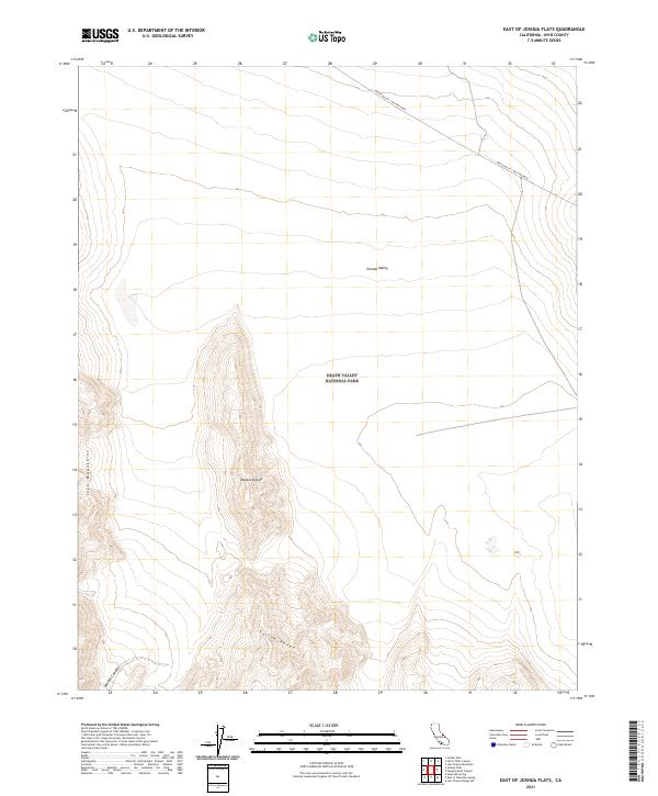
2021 Map of East of Joshua Flats
USGS Topo · Published 2021About this map
Eureka Valley and the northern reaches of the Mojave Desert converge in this high-desert landscape within the boundaries of Death Valley National Park. The terrain is defined by the steep elevation changes of the Inyo Mountains to the west and the Saline Range to the south, creating a stark basin-and-range topography. A primary artery through this arid expanse is the Death Valley / Big Pine Road, which snakes across the northern sections of the map, providing a critical connection across the desert floor.
Find a feature on this map
12 named features on this map. Tap any name to fly to it.
Don’t see what you’re looking for? This feature index may not catch every label — zoom into the map to look around manually.
Map Details
Editions of this 2021 East of Joshua Flats Map
This is the sole edition of this map. No revisions or reprints were ever made.
Other maps of this area

1908 · Lida
USGS Topo · 1:250,000

1913 · Lida
USGS Topo · 1:250,000

1954 · Goldfield
USGS Topo · 1:250,000

1955 · Goldfield
USGS Topo · 1:250,000

1957 · Magruder Mtn
USGS Topo · 1:62,500

1958 · Goldfield
USGS Topo · 1:250,000

1958 · Last Chance Range
USGS Topo · 1:62,500

1958 · Soldier Pass
USGS Topo · 1:62,500
1958 · Waucoba Spring
USGS Topo · 1:62,500

1962 · Goldfield
USGS Topo · 1:250,000