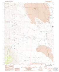
1984 Map of Fish Springs
USGS Topo · Published 1994About this map
Crater Mountain and the surrounding volcanic terrain dominate this mid-1980s landscape in the Owens Valley region of Inyo County. The eastern edge of the survey area highlights the critical water infrastructure and industrial activity of the era, centered on the Fish Springs State Fish Hatchery and numerous prospects scattered through the Poverty Hills. Large areas of lava flows are clearly delineated, creating a stark backdrop for the complex network of resource extraction sites, including the Cleveland Mines and various Open Pit Mines near the Tailing Ponds. Evidence of human movement through this high-altitude environment is found along the Mc Murry Meadows Road, which provides access to the western portion of the quadrangle where the Inyo National Forest meets the protected boundary of the John Muir Wilderness. Several drainage systems, such as Tinemaha Creek and Birch Creek, bisect the arid slopes, illustrating the vital water routes that sustained both local industry and the natural environment.
Find a feature on this map
31 named features on this map. Tap any name to fly to it.
Don’t see what you’re looking for? This feature index may not catch every label — zoom into the map to look around manually.
Map Details
Editions of this 1984 Fish Springs Map
3 editions found
Other maps of this area

1907 · Mt. Whitney
USGS Topo · 1:125,000

1913 · Bishop
USGS Topo · 1:125,000

1919 · Mt. Whitney
USGS Topo · 1:125,000

1937 · Mt. Whitney
USGS Topo · 1:125,000

1947 · Mariposa
USGS Topo · 1:250,000

1948 · Fresno
USGS Topo · 1:250,000

1948 · Mariposa
USGS Topo · 1:250,000

1950 · Big Pine
USGS Topo · 1:62,500

1951 · Waucoba Mtn.
USGS Topo · 1:62,500

1951 · Independence
USGS Topo · 1:62,500