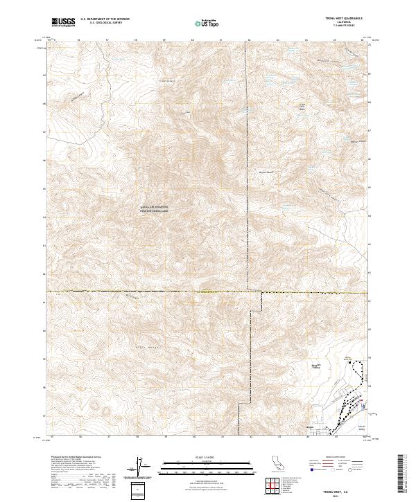
2021 Map of Trona West
USGS Topo · Published 2021About this map
Argus Range and the high peaks of the Mojave Desert define this portion of Inyo and San Bernardino counties, where the industrial presence of Searles Valley meets the high desert. The landscape is marked by a high density of named springs, such as Nadeau Springs, Indian Joe Spring, and Arrastra Spring, which historically supported early prospectors and travelers through the steep terrain of Moscow Canyon and Bainter Canyon. In the southeast corner, the settlement of Argus sits at the base of the mountains, with a residential grid featuring Athol St and Argus Ave leading toward the industrial operations at Plant Access Rd. This 2021 edition provides a detailed record of the local geography near the Searles Valley Cem, showing the proximity between the mountain wilderness and the specialized resource-extraction communities of the desert floor.
Find a feature on this map
47 named features on this map. Tap any name to fly to it.
Don’t see what you’re looking for? This feature index may not catch every label — zoom into the map to look around manually.
Map Details
Editions of this 2021 Trona West Map
This is the sole edition of this map. No revisions or reprints were ever made.
Other maps of this area

1915 · Searles Lake
USGS Topo · 1:250,000

1947 · Trona
USGS Topo · 1:250,000

1948 · Trona
USGS Topo · 1:250,000

1949 · Trona
USGS Topo · 1:62,500

1949 · Searles Lake
USGS Topo · 1:62,500

1950 · Searles Lake
USGS Topo · 1:62,500

1950 · Trona
USGS Topo · 1:62,500

1953 · Mountain Springs Canyon
USGS Topo · 1:62,500

1953 · Ridgecrest
USGS Topo · 1:62,500

1953 · Trona
USGS Topo · 1:250,000