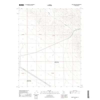
2018 Map of Horse Thief Canyon
USGS Topo · Published 2018About this map
Death Valley National Park occupies the southern extent of this desert landscape, where the high peaks of the Sylvania Mountains and the Last Chance Range define the horizon. The terrain is a complex of deep drainage systems including Horse Thief Canyon and Cucomungo Canyon, which channel seasonal runoff toward the arid expanse of Eureka Valley and the northern reaches of the Mojave Desert. This 2018 survey reveals a network of primitive access routes vital for desert travel, such as Eureka Valley Rd and Willow Creek Rd. A notable corridor for mineral exploration is established by Loretta Mine Rd, which cuts across the flats in the southwestern quadrant. These roads follow the natural contours of the land, tracing the paths of intermittent water features like Willow Creek and Willow Wash.
Find a feature on this map
17 named features on this map. Tap any name to fly to it.
Don’t see what you’re looking for? This feature index may not catch every label — zoom into the map to look around manually.
Map Details
Editions of this 2018 Horse Thief Canyon Map
This is the sole edition of this map. No revisions or reprints were ever made.
Other maps of this area

1908 · Lida
USGS Topo · 1:250,000

1913 · Lida
USGS Topo · 1:250,000

1954 · Goldfield
USGS Topo · 1:250,000

1955 · Goldfield
USGS Topo · 1:250,000

1957 · Magruder Mtn
USGS Topo · 1:62,500

1958 · Goldfield
USGS Topo · 1:250,000

1958 · Last Chance Range
USGS Topo · 1:62,500

1958 · Soldier Pass
USGS Topo · 1:62,500
1958 · Waucoba Spring
USGS Topo · 1:62,500

1962 · Goldfield
USGS Topo · 1:250,000