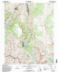
1994 Map of Mt. Thompson
USGS Topo · Published 1997About this map
High alpine lakes and Sierra Nevada crests dominate this mid-1990s survey, illustrating the recreation and resource extraction patterns of Inyo National Forest. The settlement of Aspendell serves as a gateway to the high country, where Sabrina Road and South Lake Road terminate at massive reservoirs like South Lake and Sabrina Lake. The landscape is a study in verticality, transitioning from the developed recreation sites at Bishop Park to the protected reaches of the John Muir Wilderness.
Find a feature on this map
94 named features on this map. Tap any name to fly to it.
Don’t see what you’re looking for? This feature index may not catch every label — zoom into the map to look around manually.
Map Details
Editions of this 1994 Mt. Thompson Map
This is the sole edition of this map. No revisions or reprints were ever made.
Other maps of this area

1912 · Mt. Goddard
USGS Topo · 1:125,000

1913 · Bishop
USGS Topo · 1:125,000

1947 · Mariposa
USGS Topo · 1:250,000

1948 · Mariposa
USGS Topo · 1:250,000

1948 · Mt. Goddard
USGS Topo · 1:62,500

1949 · Mt. Tom
USGS Topo · 1:62,500

1949 · Bishop
USGS Topo · 1:62,500

1950 · Big Pine
USGS Topo · 1:62,500

1951 · Mt. Tom
USGS Topo · 1:62,500

1951 · Mt. Goddard
USGS Topo · 1:62,500