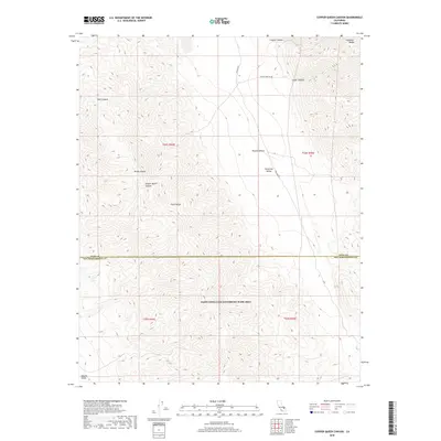
2018 Map of Copper Queen Canyon
USGS Topo · Published 2018About this map
Copper Queen Canyon cuts through the high elevation of the Slate Range in this modern topographic survey. The landscape is defined by the steep transition between the southern Panamint Range and the lower elevations of the Mojave Desert, specifically where the Panamint Valley meets Searles Valley. This desert terrain is heavily influenced by the presence of the NAWS China Lake Randsburg Wash Area, which occupies a large portion of the southern half of the quadrangle. Transportation is limited to rugged tracks such as Wingate Rd and Coyote Canyon Rd, which navigate the deep drainages of Goler Canyon and Coyote Canyon. The map records the complex topographical boundaries between Inyo and San Bernardino counties, illustrating a region where military operations and extreme desert geography intersect.
Find a feature on this map
18 named features on this map. Tap any name to fly to it.
Don’t see what you’re looking for? This feature index may not catch every label — zoom into the map to look around manually.
Map Details
Editions of this 2018 Copper Queen Canyon Map
This is the sole edition of this map. No revisions or reprints were ever made.
Other maps of this area

1915 · Searles Lake
USGS Topo · 1:250,000

1947 · Trona
USGS Topo · 1:250,000

1948 · Trona
USGS Topo · 1:250,000

1949 · Trona
USGS Topo · 1:62,500

1949 · Searles Lake
USGS Topo · 1:62,500

1950 · Searles Lake
USGS Topo · 1:62,500

1950 · Trona
USGS Topo · 1:62,500

1950 · Manly Peak
USGS Topo · 1:62,500

1950 · Wingate Pass
USGS Topo · 1:62,500

1951 · Wingate Pass
USGS Topo · 1:62,500