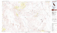
1985 Map of Last Chance Range
USGS Topo · Published 1985About this map
Mining operations and remote desert outposts define this 1980s landscape straddling the California and Nevada border. The high-altitude terrain of the White Mountains and Last Chance Range is dotted with numerous small-scale mining prospects, including the Sylvania Mine and Buck Mine, reflecting a long history of prospecting in the Sylvania Mountains. In the valleys below, small settlements such as Bonnie Claire and Gold Point serve as geographic anchors in an otherwise arid expanse of alkali flats and washes.
Find a feature on this map
72 named features on this map. Tap any name to fly to it.
Don’t see what you’re looking for? This feature index may not catch every label — zoom into the map to look around manually.
Map Details
Editions of this 1985 Last Chance Range Map
2 editions found
Other maps of this area

1898 · Silver Peak
USGS Topo · 1:125,000

1900 · Silver Peak
USGS Topo · 1:125,000

1907 · Mt. Whitney
USGS Topo · 1:125,000

1908 · Kawich
USGS Topo · 1:250,000

1908 · Lida
USGS Topo · 1:250,000

1908 · Furnace Creek
USGS Topo · 1:250,000

1908 · Ballarat
USGS Topo · 1:250,000

1910 · Furnace Creek
USGS Topo · 1:250,000

1913 · Bishop
USGS Topo · 1:125,000

1913 · Lida
USGS Topo · 1:250,000