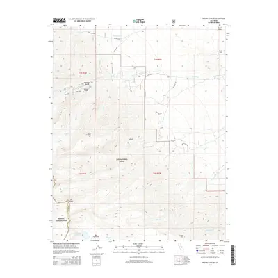
2015 Map of Mount Langley
USGS Topo · Published 2015About this map
Whitney Portal serves as a gateway to the high Eastern Sierra, marking the point where Whitney Portal Rd ends and the ascent toward the highest peaks begins. This 2015 survey illustrates the dramatic elevation changes between the Owens Valley floor and the crest of the Sierra Nevada, spanning the boundary of Inyo National Forest and Sequoia National Park. High-altitude water bodies such as Muir Lake, Peanut Lake, and Cottonwood Lake Number Five are fed by numerous drainages including Tuttle Cr and Diaz Cr. The map also captures several points of local interest, including Movie Flat and Lone Pine Peak, alongside meadows such as Big Cottonwood Meadows. The network of roads like Olivas Ranch Rd and Wilkinson Ranch Rd traces the transition from ranching and cinematic history on the valley floor to the protected wilderness of Mt Langley.
Find a feature on this map
35 named features on this map. Tap any name to fly to it.
Don’t see what you’re looking for? This feature index may not catch every label — zoom into the map to look around manually.
Map Details
Editions of this 2015 Mount Langley Map
This is the sole edition of this map. No revisions or reprints were ever made.
Other maps of this area

1905 · Olancha
USGS Topo · 1:125,000

1907 · Olancha
USGS Topo · 1:125,000

1907 · Mt. Whitney
USGS Topo · 1:125,000

1919 · Mt. Whitney
USGS Topo · 1:125,000

1937 · Mt. Whitney
USGS Topo · 1:125,000

1948 · Fresno
USGS Topo · 1:250,000

1955 · Fresno
USGS Topo · 1:250,000

1956 · Fresno
USGS Topo · 1:250,000

1956 · Mount Whitney
USGS Topo · 1:62,500

1956 · Olancha
USGS Topo · 1:62,500