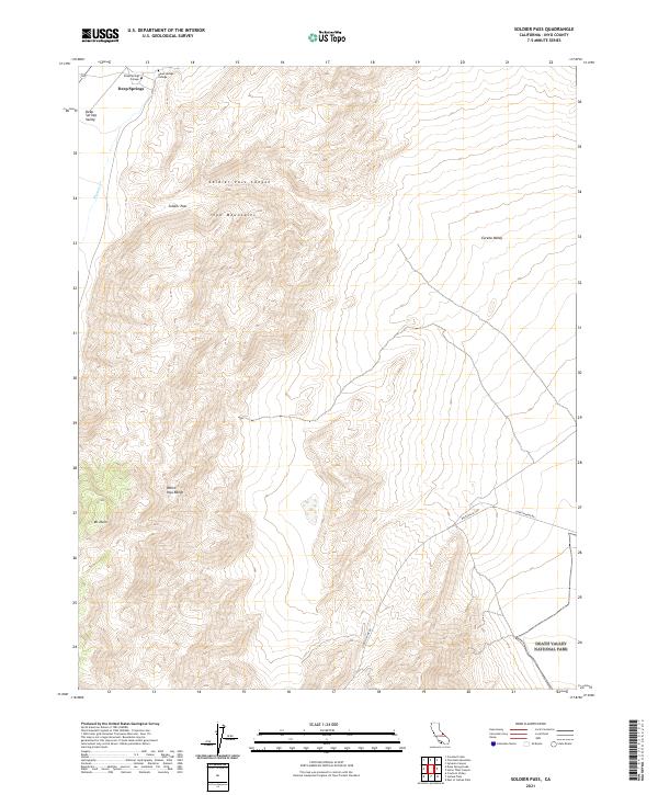
2021 Map of Soldier Pass
USGS Topo · Published 2021About this map
Deep Springs College stands as a distinct cultural landmark at the northwestern edge of this high-desert landscape, tucked near Deep Springs and the northern entrance to the Deep Springs Valley. This remote educational outpost contrasts sharply with the massive geologic features of the White-Inyo Range and the Inyo Mountains, which dominate the central and western terrain. To the east, the land descends into the vast Eureka Valley, while the southern portion of the map encompasses a section of Death Valley National Park. Transportation through these basins is limited to rugged tracks like Death Valley Rd and Loretta Mine Rd, which skirt the base of peaks such as Mt Nunn. The map illustrates a classic Great Basin transition, tracing the steep drainage of Soldier Pass Canyon from the high passes down to the arid valley floors.
Find a feature on this map
17 named features on this map. Tap any name to fly to it.
Don’t see what you’re looking for? This feature index may not catch every label — zoom into the map to look around manually.
Map Details
Editions of this 2021 Soldier Pass Map
This is the sole edition of this map. No revisions or reprints were ever made.
Other maps of this area

1908 · Lida
USGS Topo · 1:250,000

1913 · Bishop
USGS Topo · 1:125,000

1913 · Lida
USGS Topo · 1:250,000

1947 · Mariposa
USGS Topo · 1:250,000

1948 · Mariposa
USGS Topo · 1:250,000

1951 · Blanco Mountain
USGS Topo · 1:62,500

1951 · Waucoba Mtn.
USGS Topo · 1:62,500

1954 · Goldfield
USGS Topo · 1:250,000

1955 · Goldfield
USGS Topo · 1:250,000

1957 · Mariposa
USGS Topo · 1:250,000