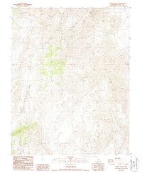
1987 Map of Joshua Flats
USGS Topo · Published 1987About this map
Joshua Flats and the nearby Cowhorn Valley reveal a landscape shaped by mineral exploration and rugged relief along the border of Inyo County. This 1987 provisional survey documents several extraction sites, most notably the Nikolaus Eureka Mine located in the northern hills. The terrain is marked by numerous prospects and isolated quarries, indicating a period where small-scale mining and resource sampling were common across the high desert ridges. Beyond the industrial sites, prominent geographic landmarks such as Lime Hill and a specific Borrow Pit provide spatial context to a region otherwise defined by its sparse settlement and high-altitude valleys. The map serves as a detailed record of the physical land features before more modern transformations, preserving the locations of specific mining claims and the primitive road network that connected these remote operations.
Find a feature on this map
11 named features on this map. Tap any name to fly to it.
Don’t see what you’re looking for? This feature index may not catch every label — zoom into the map to look around manually.
Map Details
Editions of this 1987 Joshua Flats Map
This is the sole edition of this map. No revisions or reprints were ever made.
Other maps of this area

1908 · Lida
USGS Topo · 1:250,000

1913 · Bishop
USGS Topo · 1:125,000

1913 · Lida
USGS Topo · 1:250,000

1947 · Mariposa
USGS Topo · 1:250,000

1948 · Mariposa
USGS Topo · 1:250,000

1951 · Blanco Mountain
USGS Topo · 1:62,500

1951 · Waucoba Mtn.
USGS Topo · 1:62,500

1954 · Goldfield
USGS Topo · 1:250,000

1955 · Goldfield
USGS Topo · 1:250,000

1957 · Mariposa
USGS Topo · 1:250,000