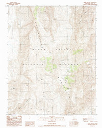
1988 Map of White Top Mtn
USGS Topo · Published 1988About this map
The high ridges of White Top Mountain and the Cottonwood Mountains dominate this 1980s landscape within the Death Valley National Monument. The area is defined by its arid geology and scattered water sources, which were vital for early exploration and mining. Isolated springs, including Burro Spring, Quartz Spring, and Rest Spring, punctuate the high-elevation terrain, providing rare points of reliable water. The network of 4wd routes suggests a history of difficult access, while several Prospects and a Mine point toward the mineral interest that drew people to these remote canyons. Deep geological cuts like Bighorn Gorge and Perdido Canyon carve through the mountains, while a solitary Corral and Dry Bone Canyon in the south reflect the sparse human imprint on this protected California desert landscape.
Find a feature on this map
16 named features on this map. Tap any name to fly to it.
Don’t see what you’re looking for? This feature index may not catch every label — zoom into the map to look around manually.
Map Details
Editions of this 1988 White Top Mtn Map
This is the sole edition of this map. No revisions or reprints were ever made.
Other maps of this area

1908 · Ballarat
USGS Topo · 1:250,000

1913 · Ballarat
USGS Topo · 1:250,000

1948 · Death Valley
USGS Topo · 1:250,000

1950 · Ubehebe Peak
USGS Topo · 1:62,500

1951 · Ubehebe Peak
USGS Topo · 1:62,500

1951 · Marble Canyon
USGS Topo · 1:62,500

1954 · Death Valley
USGS Topo · 1:250,000

1956 · Death Valley
USGS Topo · 1:250,000

1957 · Death Valley
USGS Topo · 1:250,000

1957 · Tin Mountain
USGS Topo · 1:62,500