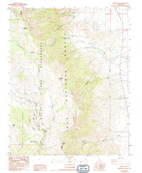
1987 Map of Haiwee Pass
USGS Topo · Published 1994About this map
The Pacific Crest National Scenic Trail winds along the high-elevation crest of the Sierra Nevada, marking a divide between the lush basins to the west and the arid expanses of the Owens Valley to the east. This 1987 survey details a landscape defined by dramatic shifts in topography, where the headwaters of the South Fork Kern River and Honeybee Creek originate near the Tulare and Inyo county line. The high-country terrain includes landmarks such as Round Mountain and the high Summit, alongside remote meadows like Bear Trap Meadow and Summit Meadow. Evidence of earlier resource extraction and transportation is found in a lone Prospect and the Old Railroad Grade that cuts across the valley floor. High-mountain crossings including Olancha Pass and Haiwee Pass provide historical transit points between the Golden Trout Wilderness and the lower sage flats near Soda Spring.
Find a feature on this map
25 named features on this map. Tap any name to fly to it.
Don’t see what you’re looking for? This feature index may not catch every label — zoom into the map to look around manually.
Map Details
Editions of this 1987 Haiwee Pass Map
2 editions found
Other maps of this area

1905 · Olancha
USGS Topo · 1:125,000

1907 · Olancha
USGS Topo · 1:125,000

1908 · Ballarat
USGS Topo · 1:250,000

1913 · Ballarat
USGS Topo · 1:250,000

1948 · Death Valley
USGS Topo · 1:250,000

1948 · Fresno
USGS Topo · 1:250,000

1951 · Keeler
USGS Topo · 1:62,500

1951 · Haiwee Reservoir
USGS Topo · 1:62,500

1954 · Death Valley
USGS Topo · 1:250,000

1955 · Fresno
USGS Topo · 1:250,000