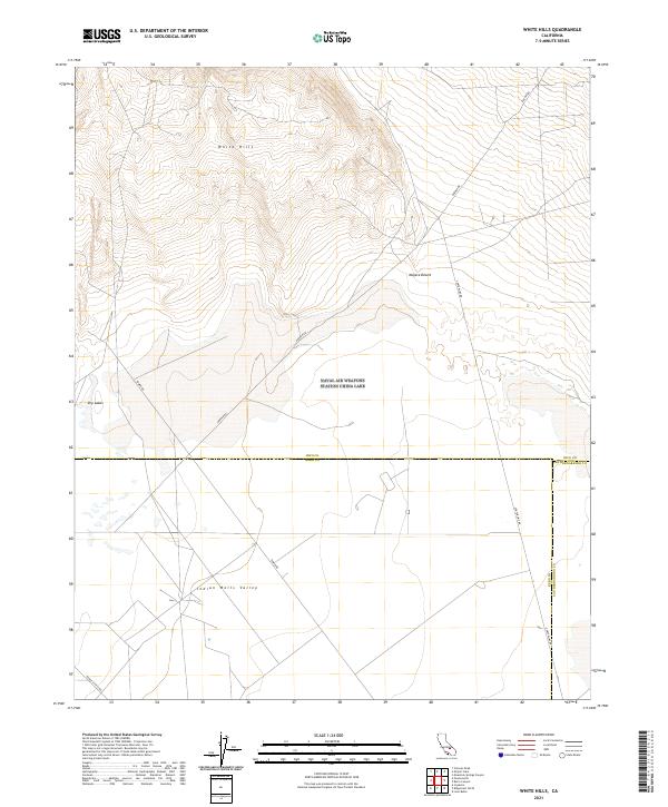
2021 Map of White Hills
USGS Topo · Published 2021About this map
The White Hills rise at the convergence of three California counties, marking a high-desert landscape where the northern reaches of the Mojave Desert transition into the Indian Wells Valley. This 2021 survey documents a sparse but strictly partitioned territory, defined by the meeting of Inyo, Kern, and San Bernardino counties. The land is navigated primarily via utility and access routes like Darwin Rd and Tower Rd, which cut through the varied topography of ridges and Dry Lakes. Because much of the area falls within specialized jurisdictions, the map records the specific road networks like Range Access Rd and Centerline Rd that serve the desert interior. The placement of these corridors reveals the modern management of this arid terrain, where natural features like the White Hills dictate the flow of travel through the basin.
Find a feature on this map
15 named features on this map. Tap any name to fly to it.
Don’t see what you’re looking for? This feature index may not catch every label — zoom into the map to look around manually.
Map Details
Editions of this 2021 White Hills Map
This is the sole edition of this map. No revisions or reprints were ever made.
Other maps of this area

1915 · Searles Lake
USGS Topo · 1:250,000

1943 · Inyokern
USGS Topo · 1:62,500

1947 · Trona
USGS Topo · 1:250,000

1948 · Trona
USGS Topo · 1:250,000

1953 · Mountain Springs Canyon
USGS Topo · 1:62,500

1953 · Ridgecrest
USGS Topo · 1:62,500

1953 · Trona
USGS Topo · 1:250,000

1954 · Little Lake
USGS Topo · 1:62,500

1957 · Trona
USGS Topo · 1:250,000

1960 · Trona
USGS Topo · 1:250,000