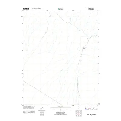
2012 Map of Horse Thief Canyon
USGS Topo · Published 2012About this map
Horse Thief Canyon and Cucomungo Canyon define this arid stretch of Inyo County, where the desert landscape is shaped by the intermittent drainage of Willow Wash and Willow Cr. This survey illustrates a portion of the eastern California desert where infrastructure is limited to long-distance thoroughfares such as Eureka Valley Rd and Death Valley Rd. The lack of permanent settlements or structures underscores the isolated nature of this terrain, where map features are almost entirely geological. Researchers of the region's topography can trace the complex network of dry washes and canyons that guide seasonal runoff through the valley floor, providing a detailed look at the drainage patterns of the high desert in the early twenty-first century.
Find a feature on this map
6 named features on this map. Tap any name to fly to it.
Don’t see what you’re looking for? This feature index may not catch every label — zoom into the map to look around manually.
Map Details
Editions of this 2012 Horse Thief Canyon Map
This is the sole edition of this map. No revisions or reprints were ever made.
Other maps of this area

1908 · Lida
USGS Topo · 1:250,000

1913 · Lida
USGS Topo · 1:250,000

1954 · Goldfield
USGS Topo · 1:250,000

1955 · Goldfield
USGS Topo · 1:250,000

1957 · Magruder Mtn
USGS Topo · 1:62,500

1958 · Goldfield
USGS Topo · 1:250,000

1958 · Last Chance Range
USGS Topo · 1:62,500

1958 · Soldier Pass
USGS Topo · 1:62,500
1958 · Waucoba Spring
USGS Topo · 1:62,500

1962 · Goldfield
USGS Topo · 1:250,000