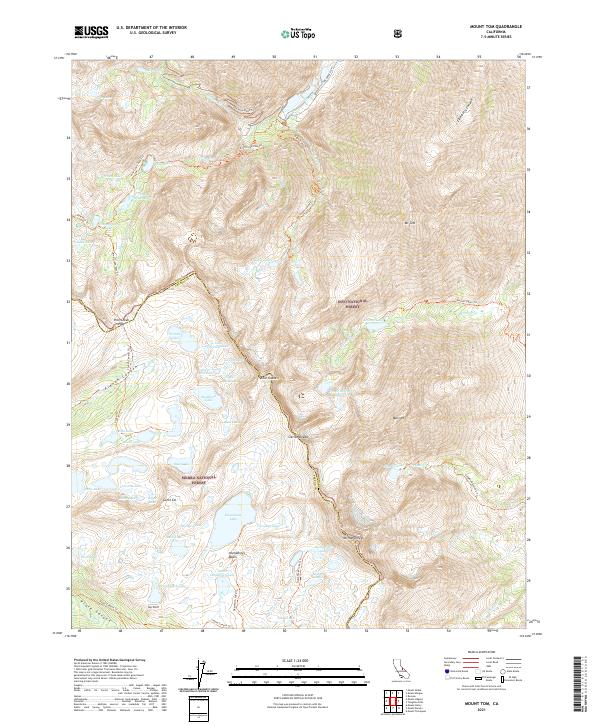
2021 Map of Mount Tom
USGS Topo · Published 2021About this map
The Sierra Nevada mountain range dominates this 2021 study, where the high-altitude boundary between the Inyo National Forest and Sierra National Forest is defined by some of the region's most prominent peaks. Landmarks such as Mt Tom and Mt Humphreys tower over a glaciated landscape characterized by steep-walled cirques and high-basin hydrology. The mapping reveals a complex network of alpine trails, including the Pine Creek Pass Trl and the Horton Lakes Trl, which provide the primary access to isolated water bodies like Gable Lakes, Steelhead Lake, and French Lake. An interesting industrial vestige appears in the northern section as the Morgan Mine Road-Trl, suggesting the historical reach of mining operations into these high elevations. This modern topographic record preserves the precise locations of named summits like Four Gables and the drainage patterns of French Canyon and Elderberry Canyon.
Find a feature on this map
77 named features on this map. Tap any name to fly to it.
Don’t see what you’re looking for? This feature index may not catch every label — zoom into the map to look around manually.
Map Details
Editions of this 2021 Mount Tom Map
This is the sole edition of this map. No revisions or reprints were ever made.
Other maps of this area

1912 · Mt. Goddard
USGS Topo · 1:125,000

1947 · Mariposa
USGS Topo · 1:250,000

1948 · Mariposa
USGS Topo · 1:250,000

1948 · Mt. Goddard
USGS Topo · 1:62,500

1949 · Mt. Tom
USGS Topo · 1:62,500

1951 · Mt. Tom
USGS Topo · 1:62,500

1951 · Mt. Goddard
USGS Topo · 1:62,500

1952 · Mt. Goddard
USGS Topo · 1:62,500

1953 · Mt Abbot
USGS Topo · 1:62,500

1953 · Blackcap Mtn
USGS Topo · 1:62,500