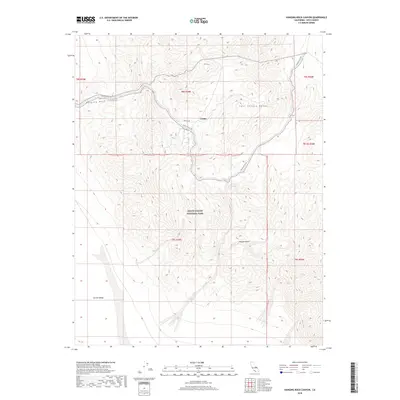
2018 Map of Hanging Rock Canyon
USGS Topo · Published 2018About this map
Crater sits as a solitary named settlement within the high-desert terrain of the northern Mojave Desert, marking a point of human presence in a landscape dominated by the Last Chance Range. This 2018 survey documents a remote portion of Death Valley National Park, where the transition from the rugged peaks of the range down into Eureka Valley is defined by sharp elevation changes and deeply incised desert washes. The transport network is limited to a few arterial routes like Death Valley Rd and the aptly named Sulfur Rd, which trace the natural contours through Hanging Rock Canyon. This map provides a modern record of the survey lines and public land boundaries that organize this protected wilderness, illustrating the stark topography of one of the most arid environments in the American West.
Find a feature on this map
14 named features on this map. Tap any name to fly to it.
Don’t see what you’re looking for? This feature index may not catch every label — zoom into the map to look around manually.
Map Details
Editions of this 2018 Hanging Rock Canyon Map
This is the sole edition of this map. No revisions or reprints were ever made.
Other maps of this area

1908 · Lida
USGS Topo · 1:250,000

1913 · Lida
USGS Topo · 1:250,000

1954 · Goldfield
USGS Topo · 1:250,000

1955 · Goldfield
USGS Topo · 1:250,000

1957 · Magruder Mtn
USGS Topo · 1:62,500

1958 · Goldfield
USGS Topo · 1:250,000

1958 · Last Chance Range
USGS Topo · 1:62,500

1958 · Soldier Pass
USGS Topo · 1:62,500
1958 · Waucoba Spring
USGS Topo · 1:62,500

1962 · Goldfield
USGS Topo · 1:250,000