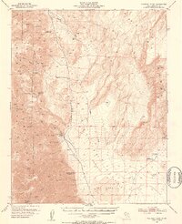
1951 Map of Waucoba Wash
USGS Topo · Published 1953About this map
Mining operations and remote springs define this 1951 topographic survey of the Inyo County desert. The eastern slopes of the Inyo Mountains descend sharply into the Saline Valley, a low-lying basin marked by The Dunes and a significant land depression. This era highlights a robust industrial presence in the high desert, with several extractive sites scattered throughout the canyons, most notably the White Eagle Talc Mine, Grey Eagle Talc Mine, and the Waucoba Tungsten Mine.
Find a feature on this map
34 named features on this map. Tap any name to fly to it.
Don’t see what you’re looking for? This feature index may not catch every label — zoom into the map to look around manually.
Map Details
Editions of this 1951 Waucoba Wash Map
3 editions found

Other maps of this area

1907 · Mt. Whitney
USGS Topo · 1:125,000

1908 · Lida
USGS Topo · 1:250,000

1908 · Ballarat
USGS Topo · 1:250,000

1913 · Bishop
USGS Topo · 1:125,000

1913 · Lida
USGS Topo · 1:250,000

1913 · Ballarat
USGS Topo · 1:250,000

1919 · Mt. Whitney
USGS Topo · 1:125,000

1937 · Mt. Whitney
USGS Topo · 1:125,000

1947 · Mariposa
USGS Topo · 1:250,000

1948 · Death Valley
USGS Topo · 1:250,000