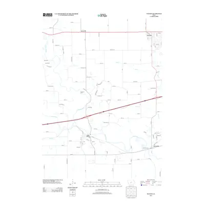
2013 Map of Waukee
USGS Topo · Published 2013About this map
Van Meter and Booneville anchor the southern portion of this landscape, where the Raccoon River and its various forks converge. The waterway is the dominant geographical influence, joined by tributaries like Bulger Cr and Sugar Cr. The map reveals a transition between established town grids and modern suburban expansion, particularly around the southern edge of Waukee. While older settlements like Ortonville maintain their place in the rural fabric, new residential networks such as Prospect Cir and Hidden Valley Dr signal shifting land use patterns in the early 21st century. Recreational and environmental management is evident through designated areas like Puckerbrush Access and Booneville Access, which preserve public entry to the riverbanks amidst the surrounding agricultural and developing terrain.
Find a feature on this map
108 named features on this map. Tap any name to fly to it.
Don’t see what you’re looking for? This feature index may not catch every label — zoom into the map to look around manually.
Map Details
Editions of this 2013 Waukee Map
This is the sole edition of this map. No revisions or reprints were ever made.
Other maps of this area

1908 · Waukee
USGS Topo · 1:62,500

1949 · Adel
USGS Topo · 1:62,500

1951 · Adel
USGS Topo · 1:62,500

1951 · St. Charles
USGS Topo · 1:62,500

1952 · Winterset
USGS Topo · 1:62,500

1954 · Omaha
USGS Topo · 1:250,000

1954 · Des Moines
USGS Topo · 1:250,000

1956 · Des Moines
USGS Topo · 1:250,000

1957 · Des Moines
USGS Topo · 1:250,000

1957 · Omaha
USGS Topo · 1:250,000